
In Tampa’s historic neighborhoods, residents know exactly where the shade disappears, and how hot those blocks can get. In parts of the city with long stretches of exposed pavement, the heat island effect can swing the temperature up to 10 degrees hotter than areas with fuller tree coverage. For residents, the difference is walkability, safety, and quality of life.
To address these disparities, the City of Tampa launched its Trees for Tampa initiative, with a goal to plant 30,000 trees in public spaces by 2030. In areas like these, urban forestry and a healthy tree canopy can be a prime strategy for climate resilience and community wellness. Leading part of that effort is RVi Associate Principal Hannah McAleer, who managed RVi’s segment of the project across several neighborhoods in Ybor City.
The work is far more involved than simply planting trees. Designing a sustainable canopy to combat heat islands required a block-by-block study of site conditions and a thorough understanding of community priorities. Ultimately, McAleer’s team mapped 88 miles of streetscape and delivered construction drawings identifying opportunities for more than 1,000 trees, each species hand-selected for suitability and community impact.
“We listened to the community organizations and the City to understand their goals and concerns,” says McAleer. “That guided our focus, and we had to put boots on the ground to really understand the constraints we were working around.”
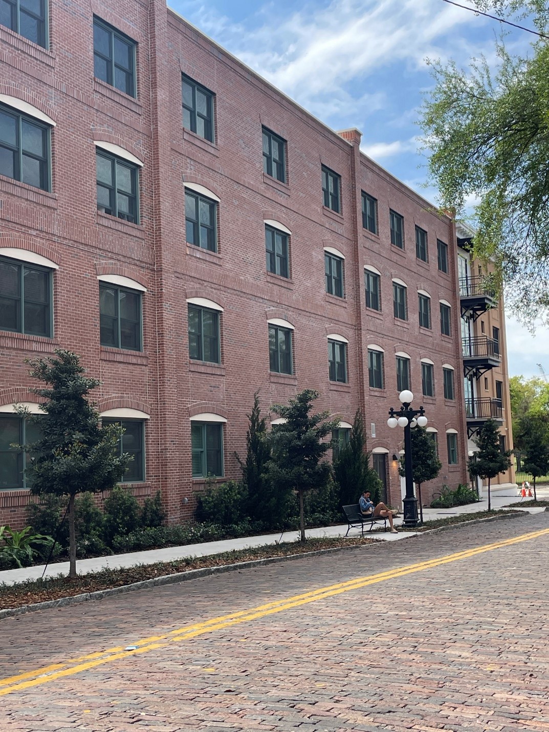
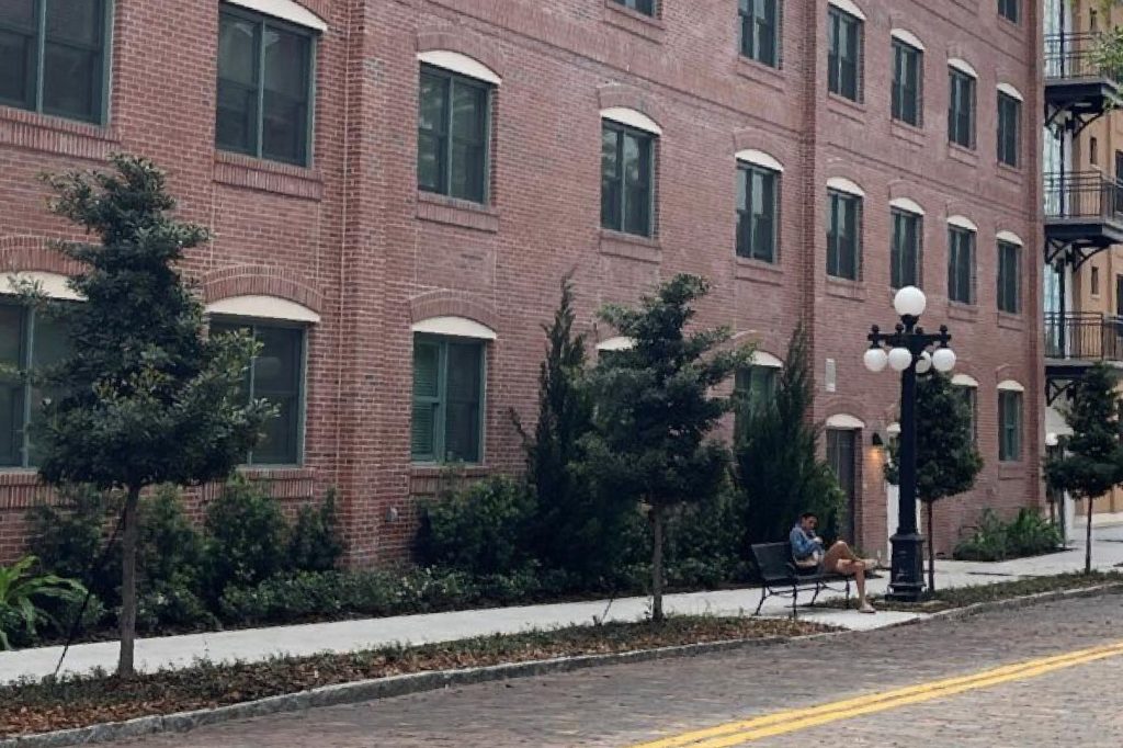
Along stretches of streetscape in Tampa’s Ybor neighborhoods, some developers have already taken initiative to begin planting new trees.
Community resilience and equity impacts
The Trees for Tampa initiative, and RVi’s role in the project, aims to achieve the proven environmental, social, and economic benefits that accompany a treed community. Urban forestry has been shown to reduce the urban heat island effect, reducing average temperatures in areas like Tampa’s heat pockets and decreasing energy expenditure on cooling. They increase air quality and mitigate greenhouse gases through the photosynthetic process at scale. Roots absorb water to aid in stormwater management throughout the City. They also contribute to the aesthetics of the community, creating a better retail and living environment that correlate to economic impacts.
Research conducted by the National Institute of Health (NIH) further demonstrates an unequal distribution of trees among lower-income communities. The City of Tampa’s Tree Canopy and Urban Forest Analysis in 2021 supported this conclusion within the City, but acknowledged the tree-planting potential in areas with less coverage. To identify neighborhoods with the highest potential for climate and socioeconomic impact, the City examined Justice40 census tracts and enlisted RVi and other consultants to develop a plan for implementation. Investing in a sustainable tree canopy across multiple underserved neighborhoods is a significant step toward environmental justice.
GIS tools to drive urban forestry
Striking a balance between the human, environmental, and design factors, McAleer and RVi leveraged GIS technology and field data collection to build a detailed database where every proposed tree is mapped, planned, and field-verified to develop an installation strategy suited for dense urban conditions.
“There wasn’t a playbook for turning site data into a set of construction documents for a project of this scale,” says McAleer. “We approached this as a team effort, bringing together viewpoints to ensure we established a framework that functioned for each phase of the project. That was the key to transitioning smoothly from data collection to community input, construction plans, and beyond.”
The team started with a desktop review to identify low-, medium-, and high-opportunity blocks, screening Google Street View for underutilized tree lawns, empty tree grates, potential utility obstructions, oversized roadways, and overall conditions. On the map, each block received a color-coded line based on opportunity level, assigning preset attributes and including detailed notes of observations. High-opportunity spaces were essentially tree-ready, while low-opportunity would require significant and costly walkway or roadway reconstruction. While planting in the most difficult of areas wasn’t included with our plans, those areas were still identified for future streetscape opportunities with the City.
Using ArcGIS Field Maps, RVi took to the streets for further observations. Our team documented what the desktop study couldn’t see—features such as informal driveways, soil nuances, parking habits, utilities, and infrastructure conflicts. We documented measurements and photos of each proposed site in the GIS app, along with notes on structural modifications and input from residents. A well-planned strategy for field documentation was critical for the team to cover almost 90 miles on foot, with the objective creating a field-verified dataset that flowed directly into construction drawings. The team’s upfront planning with Field Maps established attributes and fields that represented a variety of typical and atypical conditions, making data collection significantly more efficient.
Community-driven planning
Working in Ybor City meant navigating a complex mix of industrial, residential, historic, and economic conditions. It’s a culturally rich area with deep Cuban and Italian heritage, where old cigar factories and historic bungalow-style homes still characterize the neighborhoods. Longstanding light industrial and large commercial districts are evolving, transitioning to residential neighborhoods with small commercial and office developments and further driving the need for walkability.
“The community is proud to live and work in these neighborhoods and they desire to see investment for beautification and environmental benefit,” says McAleer. “In the various meetings with community, it was wonderful to see how excited they were about this project positively shaping the future of their neighborhood.”
Community members brought enthusiasm and insights during engagement workshops, where their tree species preferences helped shape the final planting plan.
The fieldwork created opportunities for informal engagement, with residents meeting to talk over coffee at local shops. Discussions with neighborhood leaders and the City in these informal settings drew out concerns and pointed out the routes people favored in their day to day. Their insights helped inform our data collection and shape the final plan.
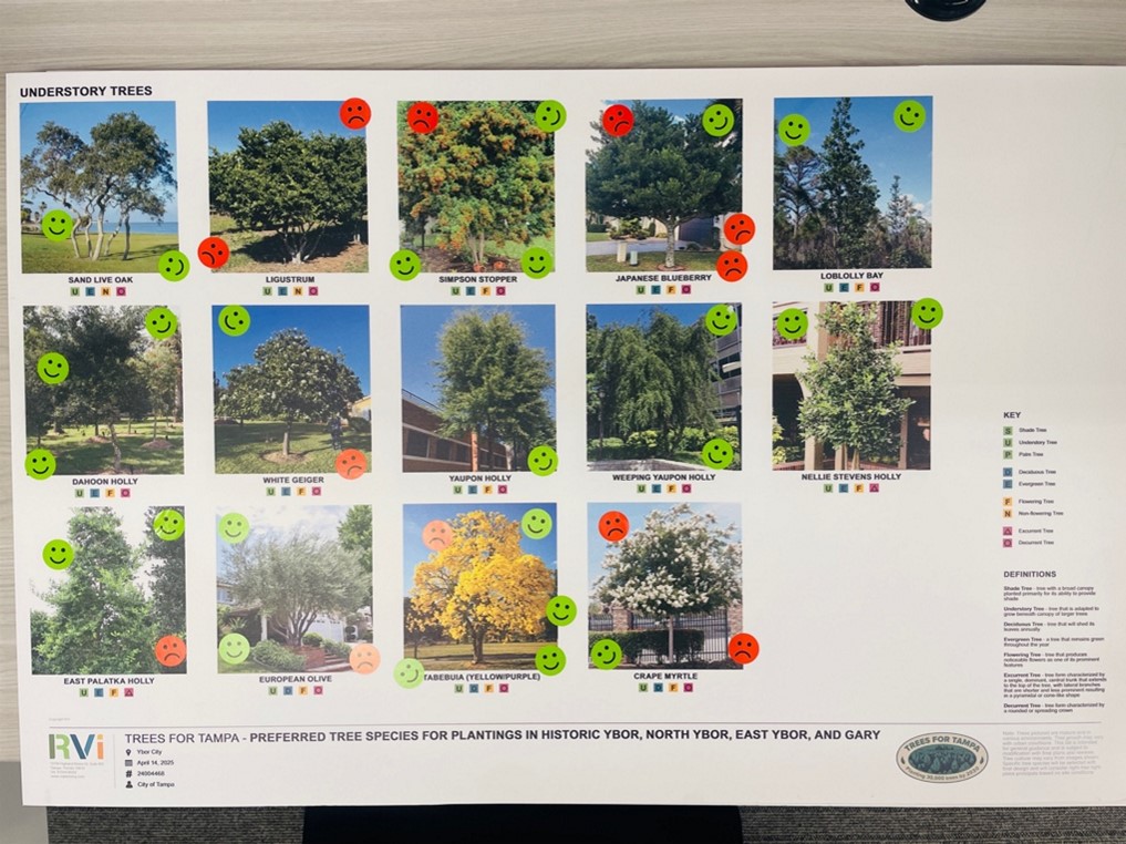
Formal community engagement included a workshop bringing all the subject neighborhoods together to learn more about the City’s many tree programs and share their project-specific priorities. Maps of tree locations and image boards of urban tree species offered visualizations for residents to learn and provide feedback. During a “green-dot/red-dot” exercise, community members reviewed tree characteristics such as canopy shape, size, persistence, and flowering habits. Attendees of the workshop filled out surveys and questionnaires, which helped guide the next level of mapping and design.
Right tree, right place: Designing a smarter urban canopy
The team quickly discovered the challenges of utilities, limited soil volume, and tree lawn utilization. The project’s success depended upon the plan’s ability to respect the urban constraints and create the conditions for trees to thrive and withstand heat and wind long after planting. In areas where a proposed high-impact canopy conflicted with hardscape conditions, the team identified installation methods and special root zone improvements to enhance survivability.
With the wealth of data in the new GIS model and substantial community input, RVi developed a species palette of 17 native and Florida-friendly trees, each selected for its suitable streetscape character, drought tolerance, storm resilience, and maintenance needs. For final mapping, the proposed trees received unique identifier numbers and points on a map that correlated to a chart outlining available planting width, presence of site-specific constraints, proposed tree types, location coordinates, and any special requirements such as sidewalk demolition and replacement, tree grates, and soil containment systems. Providing this detailed level of specifications created a construction-ready planting plan.
“The team is excited to see this plan implemented and to realize the ecological and social impact of the project over time,” McAleer says.
RVi’s commitment to creating livable public places ran true throughout this project. The city’s investment in urban canopy renewal will have measurable impacts to heat islands and climate resilience. By combining community insight with digital tools, RVi delivered a plan that will shape Tampa’s urban canopy for years to come and bring equity into underinvested neighborhoods.
More than 1,000 proposed trees have been mapped with construction-ready planning. As the city moves toward its 2030 goal to plant 30,000 trees, RVi’s efforts contribute to building healthy, resilient, and equitable public spaces for the residents of Tampa’s three Ybor neighborhoods.
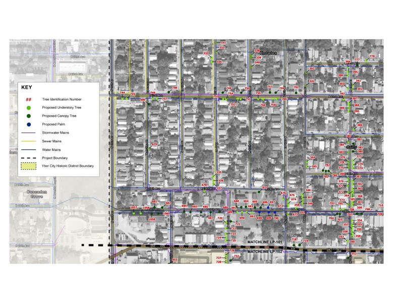
RVi’s final map lists more than 1,000 trees with unique identifier numbers and detailed modifications to ensure survivability.